

Using Drones for Contextual Site Photography in Visualizations
With the advent of technology, the world of photography has seen a revolution like never before. Among the many advancements, drones have significantly changed the landscape of how we capture images, especially in the field of contextual site photography for visualizations. Not only do they provide a unique perspective, but they also come with a plethora of benefits that were unthinkable with traditional photography methods. This blog post aims to shed light on the use of drones for capturing contextual site photographs and how they can remarkably enhance visualizations.
The Evolution of Drones in Photography
Over the past few years, drones, also known as Unmanned Aerial Vehicles (UAVs), have transitioned from military use to recreational and professional use. These high-tech devices equipped with advanced cameras have opened up new dimensions in the world of photography.
The Advent of Drone Photography
Initially, aerial photography was associated with hired helicopters or tall buildings. However, the introduction of drones changed the game entirely. Today, drones have made aerial photography accessible to everyone, from professional photographers to hobbyists and amateurs.
Types of Drones Used in Photography
There are various types of drones, each with its unique features and capabilities. Some popular drones for photography include the DJI Phantom series, the DJI Mavic series, and the Parrot Anafi, among others. These drones come equipped with high-resolution cameras and offer features like image stabilization, obstacle detection, and follow-me mode.
Utilizing Drones for Contextual Site Photography
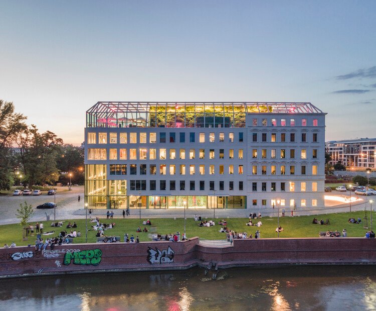
Drones have brought about a new approach to site photography. They provide a bird’s-eye view, which is particularly beneficial in contextual site photography. This form of photography aims to capture a site within its larger context, highlighting its relation to the surrounding environment.
Benefits of Using Drones in Site Photography
One of the main advantages of using drones for site photography is their ability to capture wide-angle shots from various altitudes and angles. This allows photographers to create comprehensive visualizations, giving viewers a complete understanding of the site’s context. Additionally, drones can reach locations that are otherwise difficult or impossible to access, making them an invaluable tool in site photography.
Legal and Ethical Considerations
While drones provide numerous benefits, it’s essential to be aware of the legal and ethical considerations when using them for photography. Many countries have specific regulations regarding drone use, including where they can be flown and who can operate them. Additionally, privacy concerns should be considered when capturing images in populated areas.
The Significance of Using Drones for Contextual Site Photography in Visualizations
Drones, otherwise known as unmanned aerial vehicles (UAVs), have opened up a new frontier in contextual site photography, particularly in the field of visualizations. By offering a bird’s-eye view of landscapes and structures, drones provide a unique perspective that can enhance the depth and quality of your visual presentations.
Capturing High-Resolution Aerial Imagery
One of the key advantages of using drones for contextual site photography in visualizations is their ability to capture high-resolution aerial images. These images provide comprehensive and detailed views of the site, allowing you to identify and highlight key features. This capability is especially useful in large-scale projects where ground-level photography may fail to capture the full extent of the site.
High-resolution aerial imagery also allows for more accurate and detailed visualizations. For instance, architects and planners can use these images to create realistic 3D models of the site, enhancing their design process and presentations.
The Practicality of Drones in Contextual Site Photography
Time and Cost Efficiency
The use of drones for contextual site photography in visualizations can save both time and money. Traditional methods of obtaining aerial images, such as hiring helicopters or planes, can be cost prohibitive and time-consuming. Drones, on the other hand, can be deployed quickly and at a fraction of the cost.
Moreover, drones can be equipped with advanced cameras and sensors that can capture images in various light conditions and even produce thermal and infrared images. This versatility makes drones a practical tool for site photography.
Challenges and Solutions in Using Drones for Contextual Site Photography
While drones offer numerous benefits, they also present some challenges. For instance, legal regulations may limit where and when drones can be flown. Additionally, operating drones requires technical skills and knowledge to ensure safety and effectiveness.
Meeting Regulatory Requirements
Before using drones for contextual site photography, it is crucial to understand the local regulations governing drone usage. This may include obtaining necessary permits or licenses, respecting no-fly zones, and adhering to privacy laws.
Acquiring Drone Operating Skills
Operating drones effectively requires both technical skills and an understanding of photography principles. Fortunately, there are numerous resources available, from online tutorials to certification courses, that can help you acquire these skills. Additionally, many drone manufacturers offer training and support services to their customers.
By understanding and addressing these challenges, you can fully leverage the potential of drones for contextual site photography in your visualizations.In conclusion, the use of drones for contextual site photography in visualizations is transforming the way we capture and understand our environments. This innovative technology offers a unique, bird’s-eye perspective, allowing for more comprehensive, dynamic, and detailed images that can greatly enhance visual presentations. Not only do drones offer cost-effective and efficient solutions, but they also provide a revolutionary tool for architects, designers, and planners to convey a more profound understanding of the site context. Hence, incorporating drone technology can significantly elevate the quality and depth of visualizations. Therefore, the era of using drones for contextual site photography in visualizations is not only upon us, but it is also redefining the boundaries of what is possible in this field.